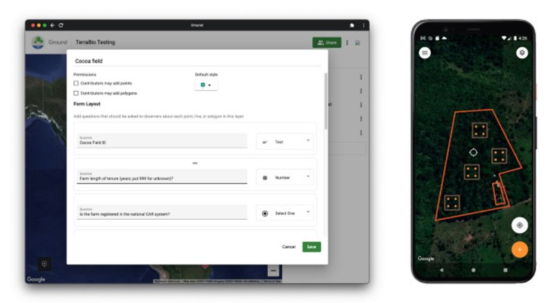
The prototype web app (left) and the Android app used to map farms and collect data (right) for the TerraBio project. Image courtesy Google Earth and Earth Engine.
Spatial Informatics Group (SIG) contributed to a fascinating mapping project described in a new post on the Google Earth and Earth Engine Medium page.
Google partnered with CIAT, SERVIR-Amazonia, SIG, and other groups on two pilot projects involving Ground, an open-source data platform that works offline—crucial in areas without wireless service—and also seamlessly connects to cloud-based storage and computation. The platform consists of an Android app for offline data collection and a web app for data management.
SIG participated in the TerraBio pilot project, a new approach for assessing the impact of private-sector investments in landscape restoration and biodiversity conservation. Here’s how Google’s post describes TerraBio:
While the private sector has extensive influence on natural resources, and many companies have pledged to adopt sustainable practices, most organizations lack strategic approaches for environmental compliance and impact evaluation. Traditional forest and biodiversity monitoring methods can be expensive, time consuming, and difficult to standardize—meaning they are generally not utilized by small- and medium-sized businesses, and are often only partially implemented by larger corporations. TerraBio aims to make compliance and evaluation at scale easy for businesses of all sizes.
The TerraBio methodology combines satellite data with environmental DNA (eDNA) extracted from soil samples. Data about land use and land management practices is also collected in the field. This data is then used to interpret the eDNA results and to validate land cover and land use maps produced for a business project. The methodology provides a cost-effective and reliable way to implement biodiversity-focused corporate accountability.
TerraBio is an assessment approach within the Catalyzing and Learning through Private Sector Engagement for Biodiversity Conservation (CAL-PSE) program, a strategic partnership between USAID/Brazil and the Alliance of Bioversity International and CIAT. The tool is being developed in collaboration with SERVIR-Amazonia, Spatial Informatics Group (SIG), and the Instituto de Manejo e Certificação Florestal e Agrícola (Imaflora).
To read the full post, click here.