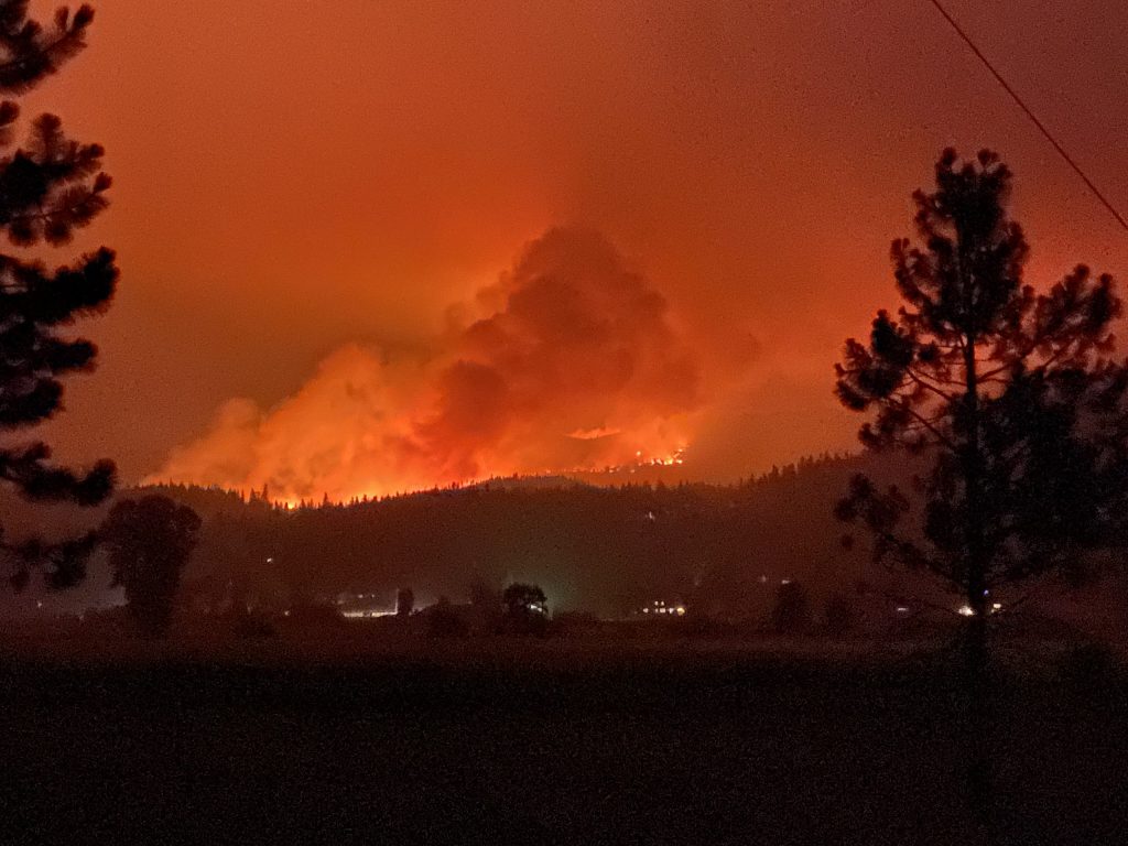
Quincy, CA, during the 2021 Fly Fire. This fire eventually combined with the Dixie Fire and burned nearly 1,000,000 acres in Northern California, destroying the communities of Greenville, Indian Falls, and Canyon Dam.
(Photo by Jason Moghaddas, SIG)
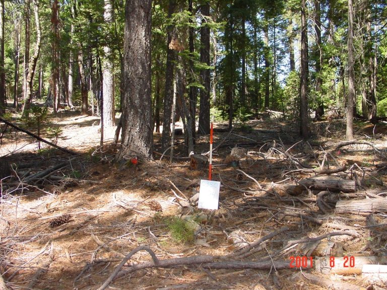
The above image shows a mixed conifer forest before treatment. This treatment was part of the National Fire and Fire Surrogate Study funded by the Joint Fire Science Program. The following images show the same forest area in various stages of the treatment process. Photo courtesy of The UC Berkeley Fire Science Lab
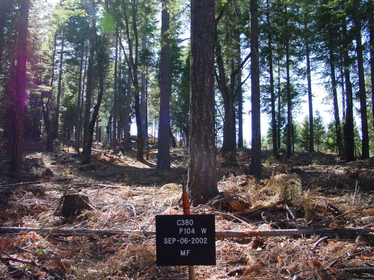
Ahead of a controlled burn, the forest was commercially thinned from below, and 80% of the small trees (less than 10 inches in diameter) were masticated. Such preparation helps to keep the prescribed burn on the ground and easier to control. Photo courtesy of The UC Berkeley Fire Science Lab
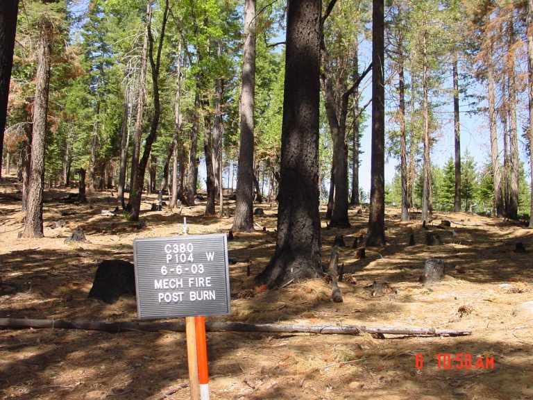
The prescribed fire that followed the commercial thinning and mastication work. Fuel treatments of this type use the power and efficiency of low-severity ground fires to reduce fuel loads in forests. When done correctly, prescribed burns reduce surface and ladder fuels. Removing these fuel sources can reduce the instances of crown fire and tree mortality in the event of a wildfire. Photo courtesy of The UC Berkeley Fire Science Lab
A current challenge facing California is to develop and expand the workforce and planning mechanism for applying vegetation treatments at an adequate scale and pace to moderating fire behavior at a landscape level. The Workforce Development Work Group is addressing this issue in coordination with multiple organizations and agencies across the state.
While there is room for improving the application of vegetation treatments, more efficient planning of such activities offers opportunities for efficiency gains, potentially taking months or even years off project timelines. Given the funding, time, and labor limitations of implementing forest vegetation treatments, implementing practical projects requires a sound understanding of a community’s past, current, and future concerns and priorities. Communities aiming for such outcomes must focus on the property, infrastructure, natural resources, and culturally significant sites affected by wildfire and wildfire mitigation efforts. Moreover, understanding current and future climate and weather patterns is paramount for planning efficient fuel reduction projects at a scale sufficient to address the magnitude of the problem.
Nearly all fuel treatments on the landscape scale are subject to federal, state, and local permitting processes such as the National Environmental Policy Act (NEPA), California Environmental Quality Act (CEQA), Timber Harvest Plans (THPS), and other permitting requirements. In addition, project litigation can further stall, limit, or eliminate fuel reduction efforts. As such, successful and timely navigation of these challenges often requires professional guidance – this is where Spatial Informatics Group (SIG) can help.
SIG has extensive experience assessing wildfire risk, developing fuel treatment strategies, and supporting clients during the planning process. Our team regularly works with land managers such as the United States Forest Service, the Department of Defense, utilities, special districts, and private landholders. We understand their concerns, priorities, and organizational structures. A big part of our success is partnering with larger organizations such as Ascent Environmental, Panorama Environmental, AECOM, SE Group, The Great Basin Institute, and others to conduct fire hazard assessments, fuel treatment prioritization, and mitigation using the latest models and data. Our partnerships help to efficiently steer our client’s projects from the drawing board to completion.
Developing and implementing a landscape-scale fuel mitigation project is a complex task. Such activities require engagement with landowners, permitting agencies, funders, contractors, and stakeholders. A typical project can take one to three years before vegetation management and prescribed fire activities can begin, and, depending on scale, another one to seven years to complete treatment implementation on the ground. While California has extensive and up-to-date public datasets to support collaborative wildfire planning efforts, regulatory requirements often change when crossing from one property to another – boundaries that fire does not recognize. To address these common impediments in the planning process, SIG is helping to build Planscape, a tool to revolutionize wildfire mitigation planning.
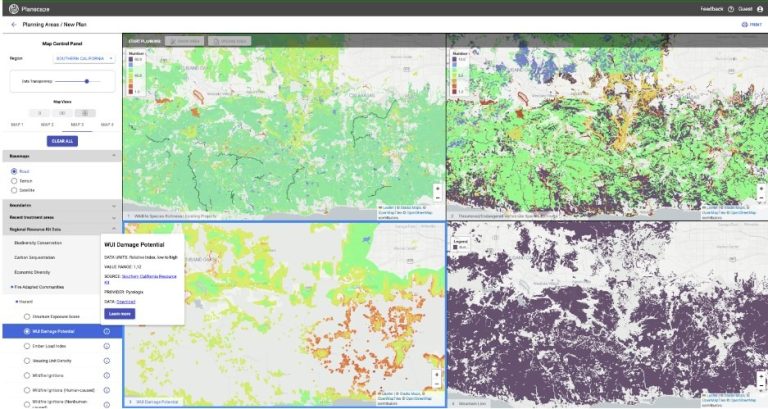
Developed in collaboration with Google.org and led by the California Natural Resources Agency (CNRA), Planscape is an open-source platform for visualizing, assessing, planning, and sharing wildfire resilience programs. Planscape captures SIG’s extensive experience in forest management planning, backed by the best state and federal data within a user-friendly format. This tool aims to help the California Natural Resources Agency and US Forest Service achieve the goal of treating one million fire-prone acres annually. Yet, regardless of project size, Planscape allows users to easily share treatment plans with partners and permitting agencies.
Additionally, SIG supports the development of Wildfire and Resilience Task Force Regional Resource Kits, including crucial data sets, metrics, and standards for evaluating project effectiveness within specific regions. Including resource kits in the Planscape platform is critical as it promises easy integration with the Governor’s plan for building fire resilience across California. To further encourage wide-scale adoption of this tool, Planscape is free and available to anyone with a computer and internet connection.
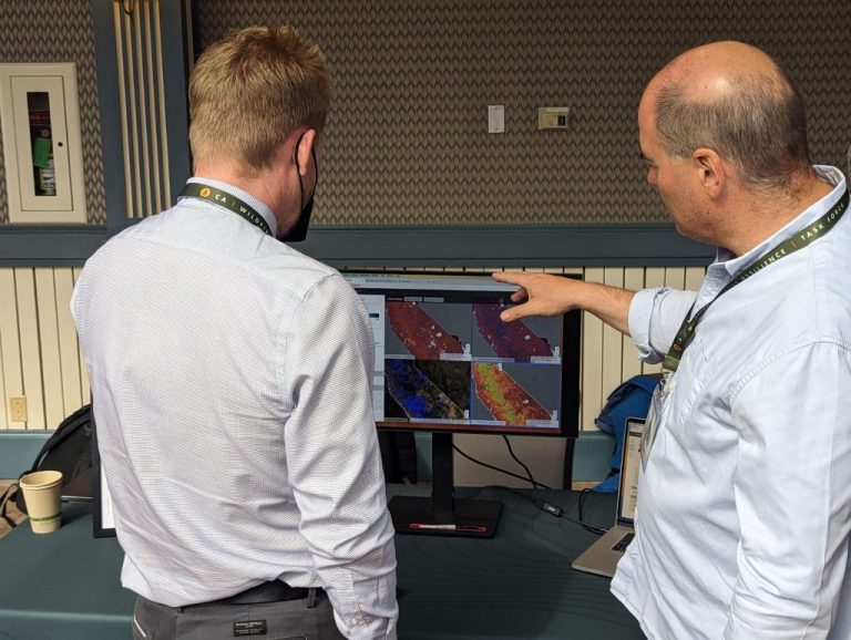
Attendees of the 2023 Calforests Forest Strategies and Innovations Conference showed enthusiasm and interest when presented with an alpha version of the tool. Such reactions came as little surprise, as we conservatively estimate that Planscape can reduce the time typically required in the treatment planning stage by 20-30 percent: a significant decrease that will free planners to focus on other challenges.
Admittedly, there is no magic wand to reduce forest treatment timelines. However, Planscape, when integrated with local knowledge and experience can streamline the planning process by centralizing data, planning materials, and GIS tools. Moreover, Planscape can facilitate further collaboration while reducing costs and decreasing planning time. Decreased planning time will help ensure that fuel treatments are implemented quickly, and at scale, so they are in place ahead of the next major wildfire.