New Report Reveals Wildfire Is Not Just A Public Lands Issue
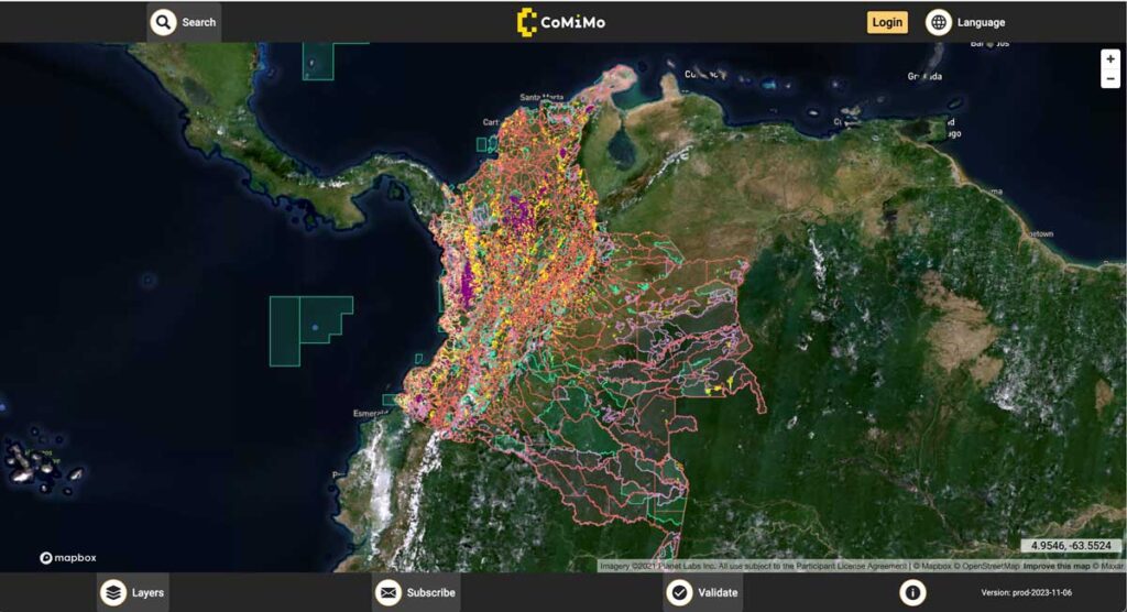
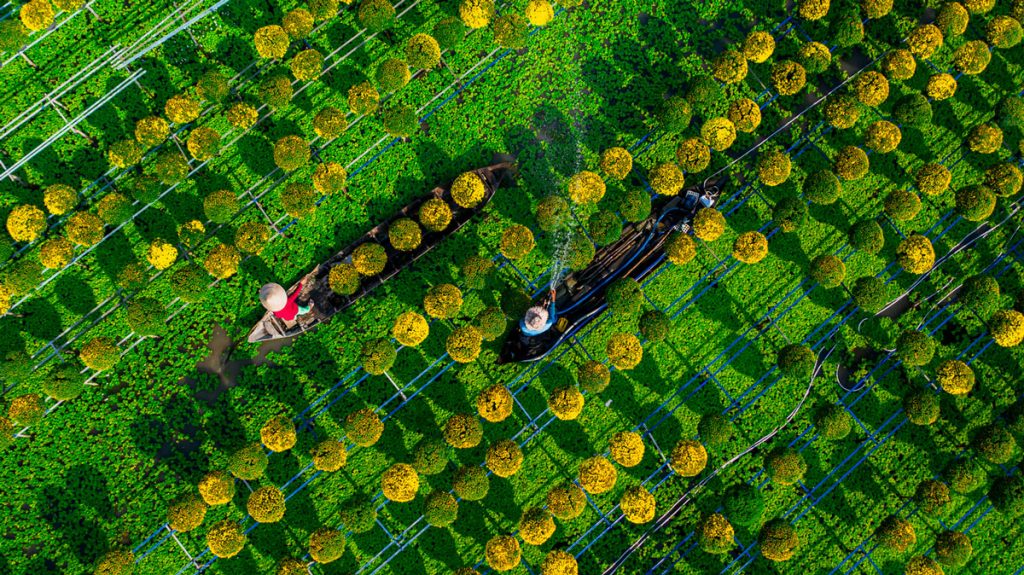
SIG co-developed software to remotely monitor gold mining activity in Colombia. Illegal mining is a driver of deforestation and this project aims to empower authorities to respond quickly and appropriately. CoMiMo, which is available for desktop in both English and Spanish, uses satellite imagery and artificial intelligence to identify threatened areas.
Developing Land Cover Mapping Technology for the KAZA Region
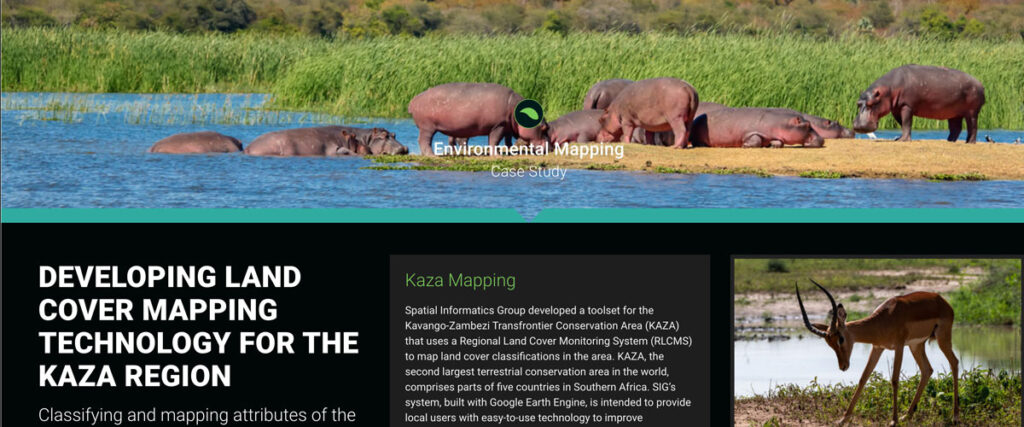
Spatial Informatics Group developed a toolset for the Kavango-Zambezi Transfrontier Conservation Area (KAZA) that uses a Regional Land Cover Monitoring System (RLCMS) to map land cover classifications in the area. KAZA, the second largest terrestrial conservation area in the world…
The Sustainable Orinoco Pact Sponsors Initiatives Fair On Sustainable Development-Villavicencio, Colombia
SIG co-developed software to remotely monitor gold mining activity in Colombia. Illegal mining is a driver of deforestation and this project aims to empower authorities to respond quickly and appropriately. CoMiMo, which is available for desktop in both English and Spanish, uses satellite imagery and artificial intelligence to identify threatened areas.
SERVIR-Amazonia Brings Data To The Ground For Better Decision-Making In The Amazon
Followers of environmental issues in the Amazon scarcely go a week without seeing news about threats to the biome. The region has been devastated with countless and constant hazards. For example, each year it experiences natural hazards like wetland degradation, salinization, destructive flooding, and severe fires, all compounded by climate change.
Hot But Not Bothered: Urban Green Space Leads To Better Health, Social Benefits

Decades of scientific research have been suggesting that humans accrue many positive benefits from nature, whether that nature be in an isolated preserve, in urban green space within the confines of a city, or simply with a look at a painting of a forest.
Connecting Space To Village: Bringing Satellite Data To The Ground To Improve Lives
SERVIR has been set up in many regions of the world, and the Lower Mekong Region is one of them. SERVIR-Mekong focuses on predicting seasonal crop yields, assessing how future climate change will impact the region, monitoring the landscape and the ecosystem services it provides, and developing climate change adaptation tools for agriculture, rangelands, fisheries and aquaculture. Over large landscapes, in complex ecosystems, and in a changing climate, people often do not have the information they need to solve local, national, and regional land use challenges.
Preventing California’s Catastrophic Wildfires Requires Careful Forest Management
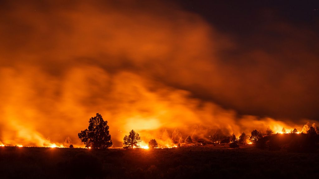
In 2015, the world experienced the strongest El Niño year on record, and forest fires tore through homes, businesses and lives in many parts of the world – one of which was California. That year 150,000 acres burned in the state, costing over USD $1 billion in insurance claims.
As Science Funding Decreases, Technology May Protect Our Ecological Future
In an increasingly populated, financially-strained, and ecologically-stressed world, scientists are facing mounting pressure to find quick answers to social and environmental challenges. But, In the field of ecology, solutions almost never come quickly. They take miles of hiking through uninviting terrain, months of laboratory sample testing, and weeks of data analyses to devise some of the most basic answers to the most basic questions. Fortunately for ecologists, new uses of technology, particularly airborne remote-sensing technology, are helping them obtain these answers more quickly than they were able to only a few years ago.