Radar Mining Monitoring RAMI
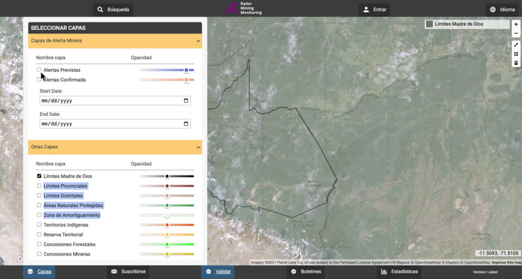
SIG’s Radar Mining Monitoring service (RAMI) helps Peru’s Ministry of Environment analyze mining impacts in the Madre de Dios region. It identifies new mining fronts, monitors ongoing activity, and classifies it as illegal, informal, or formal. SIG collaborated with SERVIR Amazonia, Conservación Amazónica, and the Programa Nacional de Conservación de Bosques to implement the service.
SIG Works With Google And Other Partners On New Tools That Democratize Offline Mapping

Spatial Informatics Group (SIG) contributed to a fascinating mapping project described in a new post on the Google Earth and Earth Engine Medium page.
Google partnered with CIAT, SERVIR-Amazonia, SIG, and other groups on two pilot projects involving Ground, an open-source data platform that works offline—crucial in areas without wireless service—and also seamlessly connects to cloud-based storage and computation. The platform consists of an Android app for offline data collection and a web app for data management.
SERVIR-Amazonia Brings Data To The Ground For Better Decision-Making In The Amazon

Followers of environmental issues in the Amazon scarcely go a week without seeing news about threats to the biome. The region has been devastated with countless and constant hazards. For example, each year it experiences natural hazards like wetland degradation, salinization, destructive flooding, and severe fires, all compounded by climate change.