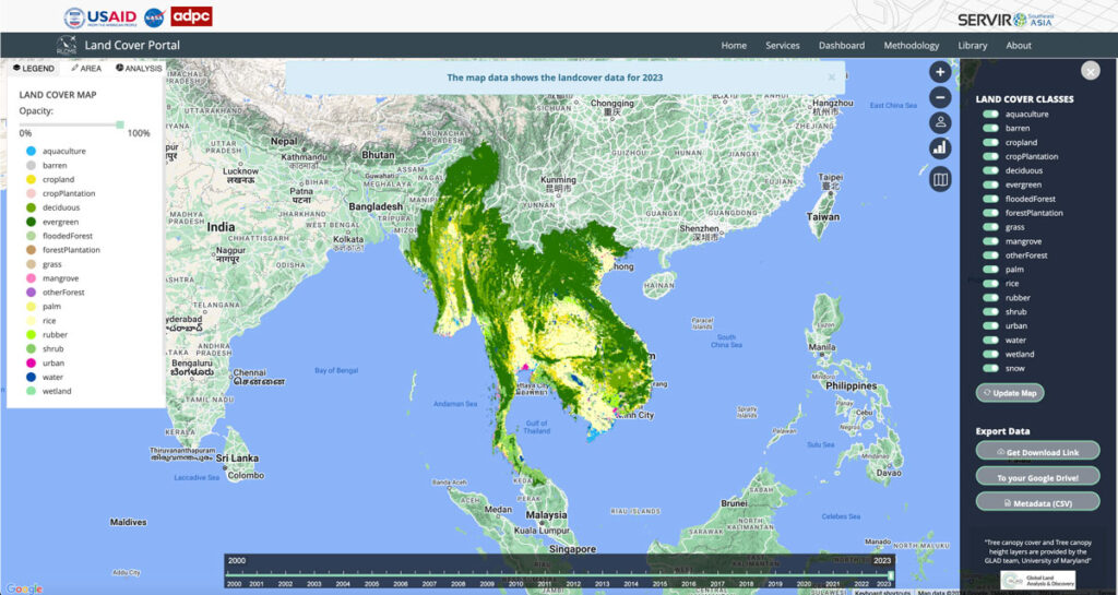
Regional Land Cover Mapping System (RLCMS)

Collaborating with NASA’s SERVIR Southeast Asia (SEA) and the Asian Disaster Preparedness Center (ADPC), Spatial Informatics Group developed AI technology to create yearly land cover maps for various uses, such as monitoring land use, land cover change, crop mapping, and more.
Forest Carbon Markets: Native People Quantify The Growing Value Of Native Lands

Carbon markets are based on the premise that sources (greenhouse gas-emitting power plants, vehicles, farm animal waste) and sinks (greenhouse gas-absorbing forests, biogas digesters, healthy soil) can be “traded” between states, regions and countries to help each other offset and reduce overall carbon emissions. While carbon markets are not a perfect solution to atmospheric carbon reduction, they have benefits…not least of which is getting communities to take stock of their natural resources and find ways to better manage, protect, and restore them.
Connecting Space To Village: Bringing Satellite Data To The Ground To Improve Lives

SERVIR has been set up in many regions of the world, and the Lower Mekong Region is one of them. SERVIR-Mekong focuses on predicting seasonal crop yields, assessing how future climate change will impact the region, monitoring the landscape and the ecosystem services it provides, and developing climate change adaptation tools for agriculture, rangelands, fisheries and aquaculture. Over large landscapes, in complex ecosystems, and in a changing climate, people often do not have the information they need to solve local, national, and regional land use challenges.
As Science Funding Decreases, Technology May Protect Our Ecological Future

In an increasingly populated, financially-strained, and ecologically-stressed world, scientists are facing mounting pressure to find quick answers to social and environmental challenges. But, In the field of ecology, solutions almost never come quickly. They take miles of hiking through uninviting terrain, months of laboratory sample testing, and weeks of data analyses to devise some of the most basic answers to the most basic questions. Fortunately for ecologists, new uses of technology, particularly airborne remote-sensing technology, are helping them obtain these answers more quickly than they were able to only a few years ago.

