Regional Land Cover Mapping System (RLCMS)
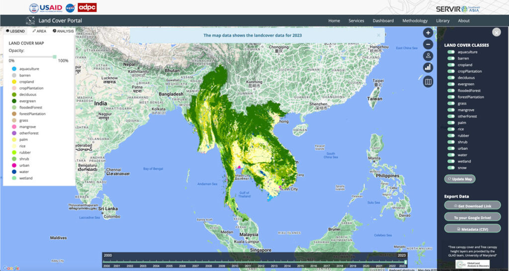
Collaborating with NASA’s SERVIR Southeast Asia (SEA) and the Asian Disaster Preparedness Center (ADPC), Spatial Informatics Group developed AI technology to create yearly land cover maps for various uses, such as monitoring land use, land cover change, crop mapping, and more.
SIG Works With Google And Other Partners On New Tools That Democratize Offline Mapping

Spatial Informatics Group (SIG) contributed to a fascinating mapping project described in a new post on the Google Earth and Earth Engine Medium page.
Google partnered with CIAT, SERVIR-Amazonia, SIG, and other groups on two pilot projects involving Ground, an open-source data platform that works offline—crucial in areas without wireless service—and also seamlessly connects to cloud-based storage and computation. The platform consists of an Android app for offline data collection and a web app for data management.
Simple Tech For Land Management: Training Local Users For Faster, Cost-Effective Results

Tribal leaders in remote Vietnam now use e-tablets to map lands, showing how tech helps rural communities leapfrog development and modernize.
Forest Carbon Markets: Native People Quantify The Growing Value Of Native Lands

Carbon markets are based on the premise that sources (greenhouse gas-emitting power plants, vehicles, farm animal waste) and sinks (greenhouse gas-absorbing forests, biogas digesters, healthy soil) can be “traded” between states, regions and countries to help each other offset and reduce overall carbon emissions. While carbon markets are not a perfect solution to atmospheric carbon reduction, they have benefits…not least of which is getting communities to take stock of their natural resources and find ways to better manage, protect, and restore them.
The Sustainable Orinoco Pact Sponsors Initiatives Fair On Sustainable Development-Villavicencio, Colombia

SIG co-developed software to remotely monitor gold mining activity in Colombia. Illegal mining is a driver of deforestation and this project aims to empower authorities to respond quickly and appropriately. CoMiMo, which is available for desktop in both English and Spanish, uses satellite imagery and artificial intelligence to identify threatened areas.
SIG Working In Kenya On Biomass Supply Chain
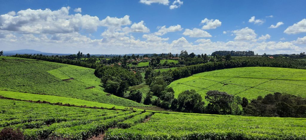
Dr. Thomas Buchholz, Senior Scientist at SIG, will be in Kenya this spring to provide assistance in biomass supply chain management to the Kenya Tea Development Agency (KTDA). He is collaborating with the Strathmore Energy Research Centre based at Strathmore University in Nairobi on this task. KTDA is in need to provide a more secure, cost-effective, and sustainable fuelwood supply over the long-term. To meet those needs, KTDA is looking at various alternatives and monitoring programs for their currently small-scale farmer based fuelwood sourcing strategy. Dr. Buchholz leads the Forest and Agriculture domain at Spatial Informatics Group.