Skip to content
SIG Spatial Informatics Group logo
  • Science Groups
    • Environmental Mapping
    • Carbon Offsets
    • Natural Hazards
    • Ecosystem Services
    • Forest & Agriculture Management
  • Solutions
    • Environmental Mapping
    • Carbon Oftsets
    • Environmental Software
    • Natural Hazards
    • Ecosystem Services
    • Forest & Agriculture Management
    • Climate Change
    • Uncrewed Aircraft Systems
  • About
    • About us
    • Contact us
    • Open Science
    • Careers
    • Privacy Policy
  • News
  • Blog
Close
Close
  • Science Groups
    • Environmental Mapping
    • Carbon Offsets
    • Natural Hazards
    • Ecosystem Services
    • Forest & Agriculture Management
  • Solutions
    • Environmental Mapping
    • Carbon Oftsets
    • Environmental Software
    • Natural Hazards
    • Ecosystem Services
    • Forest & Agriculture Management
    • Climate Change
    • Uncrewed Aircraft Systems
  • About
    • About us
    • Contact us
    • Open Science
    • Careers
    • Privacy Policy
  • News
  • Blog

Tag: Monitoring Agriculture

Improving Nepal’s Forest Change Estimation

Nepal’s Forest Change Estimation

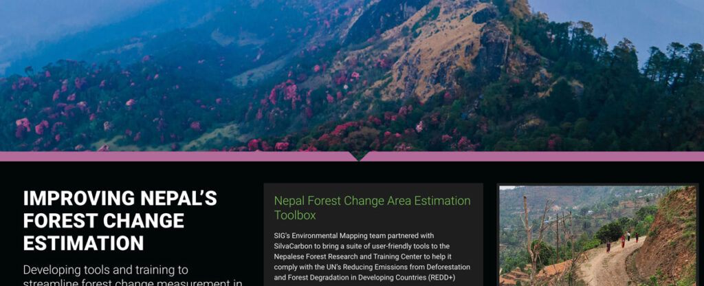
SIG’s Environmental Mapping team partnered with SilvaCarbon to bring a suite of user-friendly tools to the Nepalese Forest Research and Training Center in Nepal.

Cultivating Success: Cambodia’s Crop Mapping Powered By Tensorflow And Google Earth Engine

Neural Network Crop Mapping in Cambodia

To ensure that the initiatives developed adequately addressed Cambodia’s needs, SIG teams worked closely with the Cambodian Department of Agriculture and Land Resource Management (DALRM), identifying gaps in the existing data and developing a remote sensing-based approach to improve existing methods of crop mapping.

The Sustainable Orinoco Pact Sponsors Initiatives Fair On Sustainable Development-Villavicencio, Colombia

Sustainable Orinoco

SIG co-developed software to remotely monitor gold mining activity in Colombia. Illegal mining is a driver of deforestation and this project aims to empower authorities to respond quickly and appropriately. CoMiMo, which is available for desktop in both English and Spanish, uses satellite imagery and artificial intelligence to identify threatened areas.

Info

Contact Us
info@sig-gis.com
Spatial Informatics Group
2529 Yolanda Ct.
Pleasanton, CA 94566

Science Groups

Environmental Mapping
Carbon Offsets
Natural Hazards
Ecosystem Services
Forest and Agriculture Management
Environmental Software

Law

  • Privacy Policy
Spatial Informatics group - SIG
  • © Spatial Informatics Group, SIG 2024