Regional Land Cover Mapping System (RLCMS)
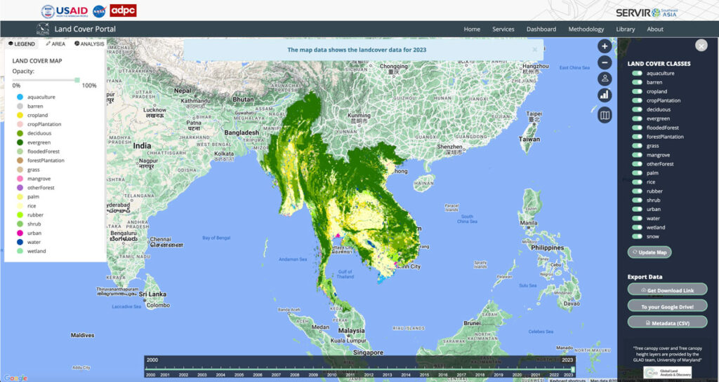
Collaborating with NASA’s SERVIR Southeast Asia (SEA) and the Asian Disaster Preparedness Center (ADPC), Spatial Informatics Group developed AI technology to create yearly land cover maps for various uses, such as monitoring land use, land cover change, crop mapping, and more.
Simple Tech For Land Management: Training Local Users For Faster, Cost-Effective Results

Tribal leaders in remote Vietnam now use e-tablets to map lands, showing how tech helps rural communities leapfrog development and modernize.
The Sustainable Orinoco Pact Sponsors Initiatives Fair On Sustainable Development-Villavicencio, Colombia

SIG co-developed software to remotely monitor gold mining activity in Colombia. Illegal mining is a driver of deforestation and this project aims to empower authorities to respond quickly and appropriately. CoMiMo, which is available for desktop in both English and Spanish, uses satellite imagery and artificial intelligence to identify threatened areas.
SERVIR-Amazonia Brings Data To The Ground For Better Decision-Making In The Amazon

Followers of environmental issues in the Amazon scarcely go a week without seeing news about threats to the biome. The region has been devastated with countless and constant hazards. For example, each year it experiences natural hazards like wetland degradation, salinization, destructive flooding, and severe fires, all compounded by climate change.
Preventing California’s Catastrophic Wildfires Requires Careful Forest Management
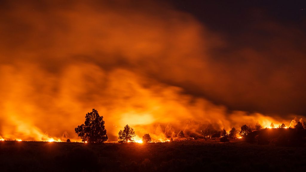
In 2015, the world experienced the strongest El Niño year on record, and forest fires tore through homes, businesses and lives in many parts of the world – one of which was California. That year 150,000 acres burned in the state, costing over USD $1 billion in insurance claims.