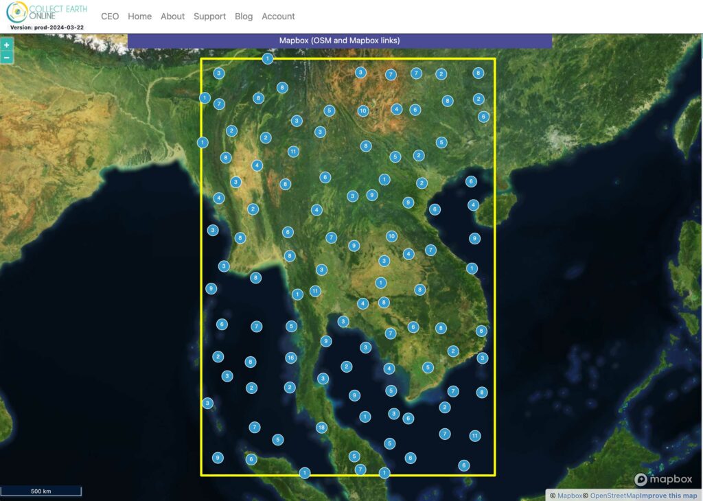
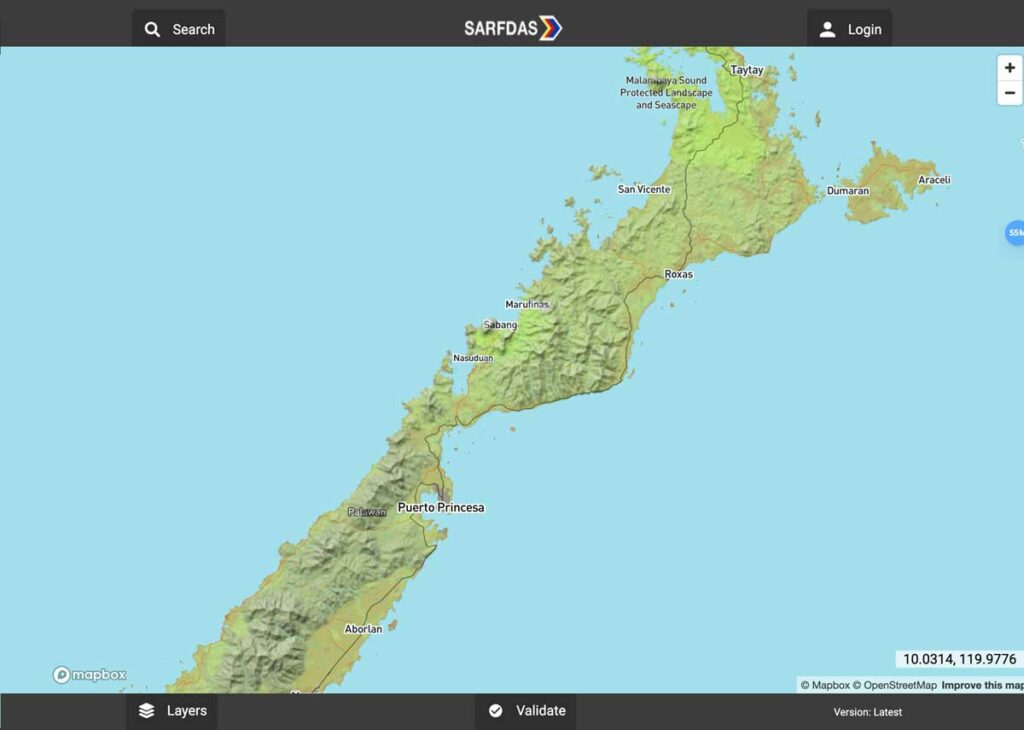
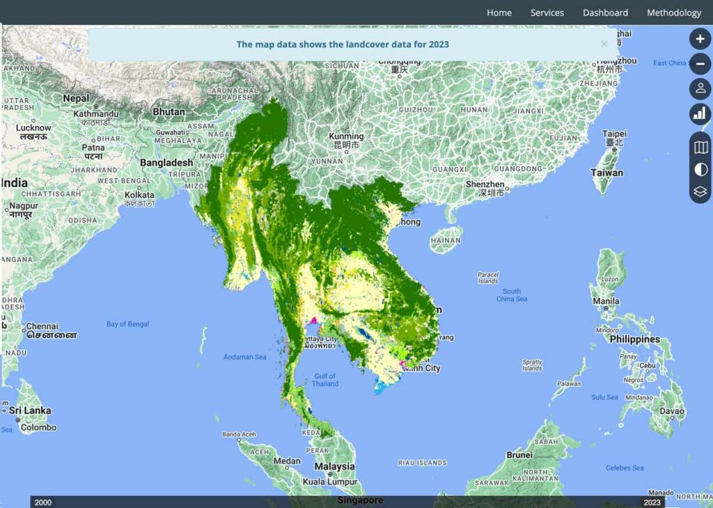
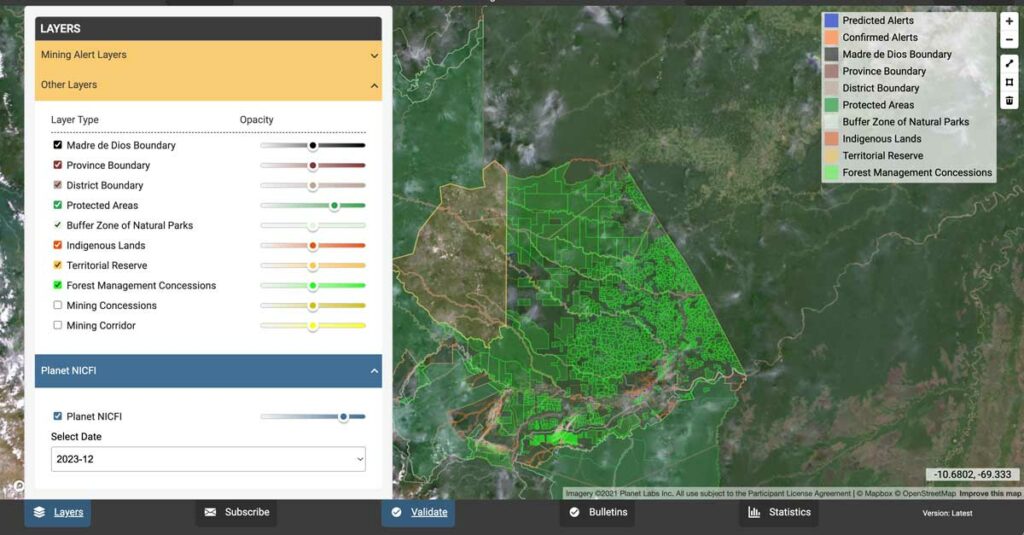
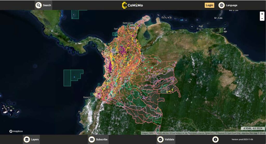
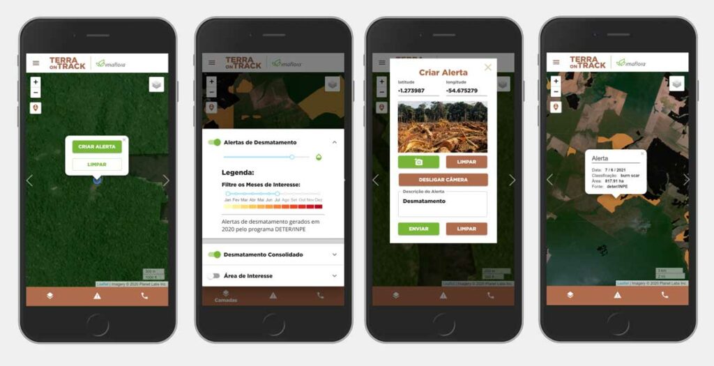
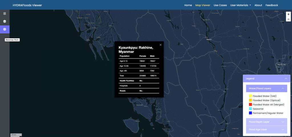
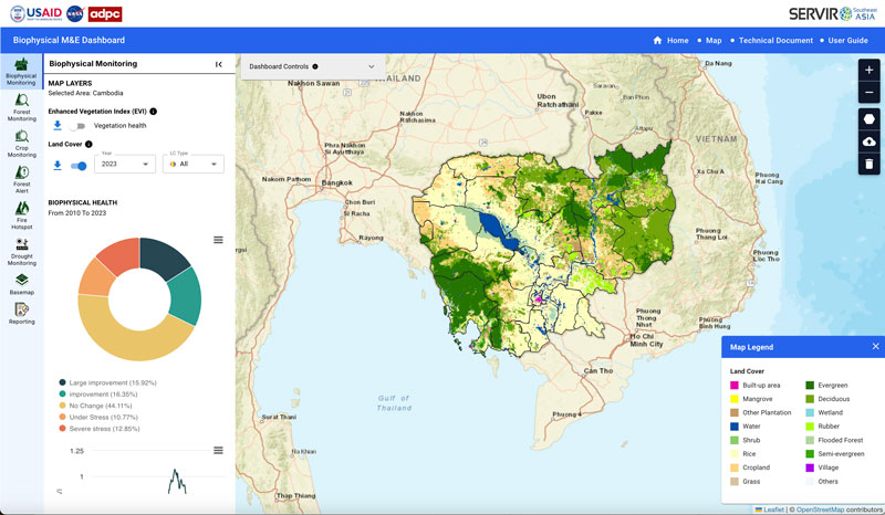
Spatial Informatics Group’s Environmental Mapping Solutions leverage satellite imagery, machine learning, artificial intelligence, and cloud computing to transform geospatial data into elegant, intuitive tools that provide decision makers with actionable information about their environment.
Our Environmental Mapping Solutions bring top-tier data sources and world-class academic insights to land managers all over the world. SIG’s Environmental Mapping team is global, with key people in Brazil, Peru, Colombia, Ecuador, Japan, Thailand, Cambodia, and the USA.
In keeping with SIG’s open science approach, many of these powerful tools are freely available online, transforming the capabilities of land management agencies around the globe.