TerraOnTrack

Web app combining geospatial datasets with near-real-time data from communities on the ground

Solution Application

Open Source

Protecting Forests from Within

Spatial Informatics Group, with partners SERVIR-SEA and Imaflora and support from NASA and USAID, created an application that allows traditional and indigenous communities in Brazil to access a wealth of information about the territories they call home. From deforestation threats to illegal activity warnings, communities can use TerraOnTrack to monitor potential problems in near-real time, upload additional information, and make informed decisions about their land.

Technical Data

System Capabilities

System Support

Mapping the Brazilian Amazon

Northern Pará State, in the Brazilian Amazon, was the initial focus of TerraOnTrack. It is a vast and difficult-to-map region, and satellite data was beyond the reach of communities there. Without the ability to monitor their lands, communities are jeopardized by a number of threats. Land grabs, illegal mining, and forest degradation can all have an impact on these groups, especially when not dealt with promptly.
TerraOnTrack Amazon

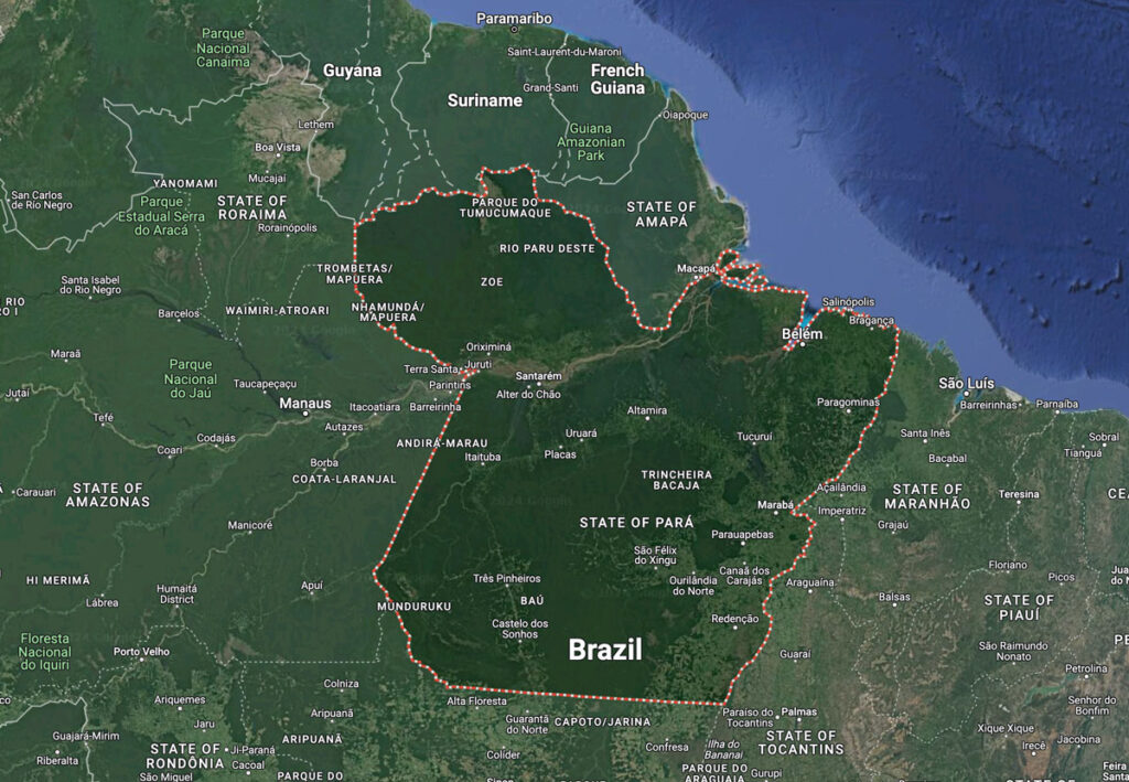
Pará State, the Brazilian Amazon

Developing TerraOnTrack

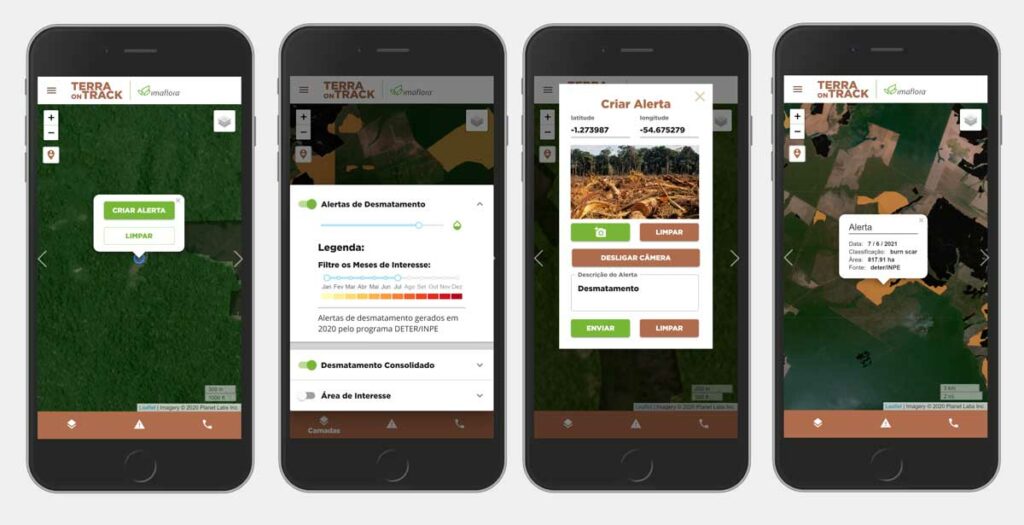
The system we created blends satellite data and imagery with a variety of tools to make an accessible web app for indigenous communities.

TerraOnTrack is built on a foundation of NASA satellite imagery layered with geographic information (such as territorial boundaries) from the Brazilian government. Users can contribute information about threats and degradation using geo-coordinates or by uploading geotagged photos from their phones, keeping the system constantly updated with relevant information. Finally, TerraOnTrack alerts community members about possible threats as soon as they are identified, giving locals far more information than previously available about their territory.

Supporting Resilient Communities

When fully implemented, TerraOnTrack will support numerous communities in Brazil with the data they need to protect their land. In 2024, Imaflora and SIG will distribute the software to different Brazilian institutions to broaden its reach, as well as instruct more potential users on how to use the application.
TerraOnTrack application screens
TerraOnTrack Design