HYDRAFloods
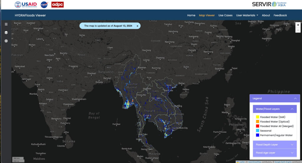
As part of SERVIR-SEA and with the Asian Disaster Preparedness Center (ADPC), SIG developed HYDRAFloods, public access flood monitoring software that detects flood events in near real-time through the use of satellite data. Artificial intelligence tools within Google Earth Engine make the program even better at detecting surface water levels, speeding up the process to keep people safe.
TerraOnTrack
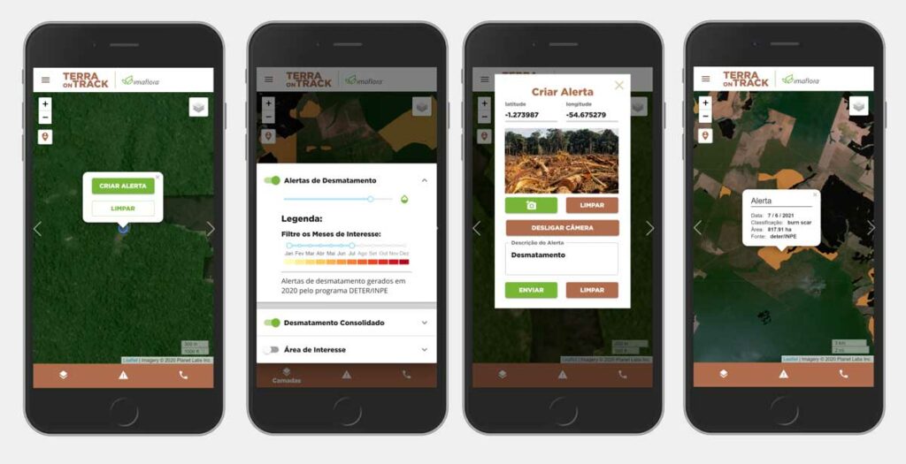
Spatial Informatics Group, with partners SERVIR-SEA and Imaflora and support from NASA and USAID, created an application that allows traditional and indigenous communities in Brazil to access a wealth of information about the territories they call home. From deforestation threats to illegal activity warnings, communities can use TerraOnTrack to monitor potential problems in near-real time, upload additional information, and make informed decisions about their land.
se.plan
se.plan is a free online tool to identify places where the benefits of forest restoration are high relative to costs. A component of the open source software suite Open Foris and part of the SEPAL system, se.plan lets users generate maps and related information on the costs and benefits of restoration efforts on any particular site.
Mapping Forest Degradation In Nepal With Remote Sensing

Under international climate change agreements, countries must estimate greenhouse gas emissions related to deforestation and forest degradation.
In cases of deforestation—when trees are cut and replaced by annual crops, for instance—the change in land cover is clearly visible. Forest degradation, by contrast, is more subtle. Trees are lost but the land remains forested and often recovers quickly—making the changes hard to detect.
SIG Works With Google And Other Partners On New Tools That Democratize Offline Mapping
Spatial Informatics Group (SIG) contributed to a fascinating mapping project described in a new post on the Google Earth and Earth Engine Medium page.
Google partnered with CIAT, SERVIR-Amazonia, SIG, and other groups on two pilot projects involving Ground, an open-source data platform that works offline—crucial in areas without wireless service—and also seamlessly connects to cloud-based storage and computation. The platform consists of an Android app for offline data collection and a web app for data management.