Pinchot Institute Works With SIG

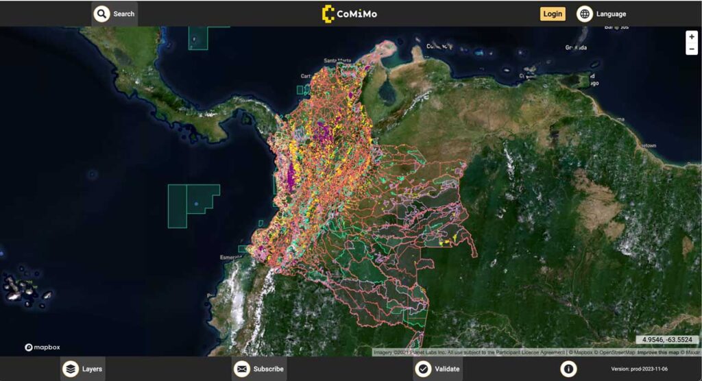
SIG co-developed software to remotely monitor gold mining activity in Colombia. Illegal mining is a driver of deforestation and this project aims to empower authorities to respond quickly and appropriately. CoMiMo, which is available for desktop in both English and Spanish, uses satellite imagery and artificial intelligence to identify threatened areas.
Carbon Dioxide Emissions Calculations For Forest Biomass Energy Projects Are Dependent Upon Regionally-Specific Conditions

An issue brief recently released by the Natural Resource Defense Council (NRDC) highlighted the importance of regional studies of biomass energy development. The brief relied on a model developed by the Spatial Informatics Group (SIG) to assess the lifecycle greenhouse gas emissions of energy derived from forest biomass in a nine-state region of the southeast United States. The model built on prior work conducted on behalf of the Southern Environmental Law Center and the National Wildlife Federation in 2012.
SIG Participates In The 6th International Wildland Fire Conference, Pyeongchang, Korea

SIG co-developed software to remotely monitor gold mining activity in Colombia. Illegal mining is a driver of deforestation and this project aims to empower authorities to respond quickly and appropriately. CoMiMo, which is available for desktop in both English and Spanish, uses satellite imagery and artificial intelligence to identify threatened areas.
SIG Provides Local Fire Management Training In Sumatra, Indonesia

Brett Shields and Dr Chris Mallek conducted a 5 day fire training course on behalf of the US Forest Service and Burung Indonesia at the Harapan Rainforest site in Jambi, Sumatra (Indonesia). Brett is SIG’s Director for Asia Pacific and Chris is a SIG affiliate with our Natural Hazards team.
