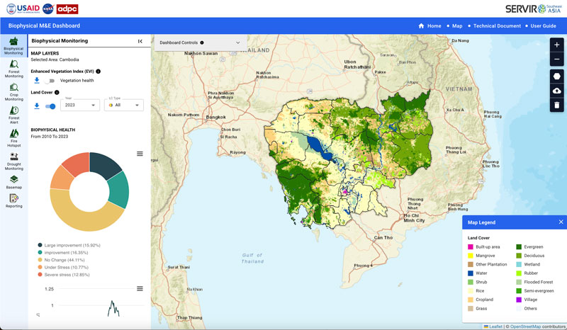
Biophysical M&E Dashboard

In support of USAID’s initiative to monitor and evaluate land cover change in Cambodia, Spatial Informatics Group and SERVIR SEA created an application powered by Google Earth Engine to allow the nation to track progress on various conservation projects.

