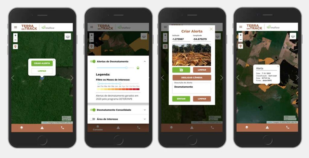
TerraOnTrack

Spatial Informatics Group, with partners SERVIR-SEA and Imaflora and support from NASA and USAID, created an application that allows traditional and indigenous communities in Brazil to access a wealth of information about the territories they call home. From deforestation threats to illegal activity warnings, communities can use TerraOnTrack to monitor potential problems in near-real time, upload additional information, and make informed decisions about their land.
SERVIR-Amazonia Brings Data To The Ground For Better Decision-Making In The Amazon

Followers of environmental issues in the Amazon scarcely go a week without seeing news about threats to the biome. The region has been devastated with countless and constant hazards. For example, each year it experiences natural hazards like wetland degradation, salinization, destructive flooding, and severe fires, all compounded by climate change.
