Close
Close
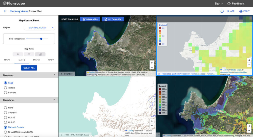
Planscape is a free, open source decision support tool designed to help wildland planning teams identify optimal areas for wildfire resilience treatments. Planscape helps regional planners prioritize wildland treatments to mitigate fire risk, maximize ecological benefits and help landscapes adapt to climate change. Planscape also helps planners identify treatments to preserve endangered habitats and optimize for carbon requirements.
The platform includes the latest available data and integrates sophisticated models like ForSys (a planning tool for treatment area identification and ranking), FVS (USFS’s forest vegetation simulator), wildfire modeling, and Treemap (tree inventory tracking).
Climate Change and past forest management practices have dramatically elevated wildfire risk around the world. Yet comprehensive forest data and sophisticated modeling tools have been available only to a handful of expert academics and researchers.
Planscape brings these powerful capabilities to land managers, heralding a new level of coordination in landscape-scale planning and investment in resilience.
Planscape is an open science collaboration of the California Natural Resources Agency, the USDA Forest Service, The California Wildfire & Forest Resilience Taskforce, University of California, Google.org, Spatial Informatics Group, the USDA Climate Hubs and Signal, and is stewarded by SIG. No commercial entity owns or profits from Planscape. We welcome new collaborators and would love to hear from anyone who wants to get involved.

As stewards of Planscape, we are constantly updating Planscape with new capabilities and additional regional support. Our roadmap includes a new Treatment Impact module for planning and analyzing both Direct and Indirect effects of treatments, inclusion of new datasets, and expanded ForSys planning capabilities. Subscribe to the Planscape newsletter for updates on progress and functionality.