Case Study
When the Save the Redwoods League acquired the Cascade Creek Property, 564 acres of mixed old- and second-growth coast redwood forest in the hills north of Santa Cruz, California, their intention was to make the parcel part of a belt of continuous protected redwood habitat from the Santa Cruz Mountains to the Pacific Ocean.
But they experienced a serious setback in 2020, when the 86,000 acre CZU Lightning Complex fires completely consumed Cascade Creek. Large patches of the property were destroyed, experiencing high-severity burn effects like total or near total overstory top-kill.
Save the Redwoods turned to Spatial Informatics Group. Our extensive experience with data collection, science-informed wildfire modeling, and remote sensing combined with trained ecologists and Registered Professional Foresters (RPFs) made SIG a natural partner to create a post-fire monitoring plan to quantify the fire’s effects and to begin tracking recovery.
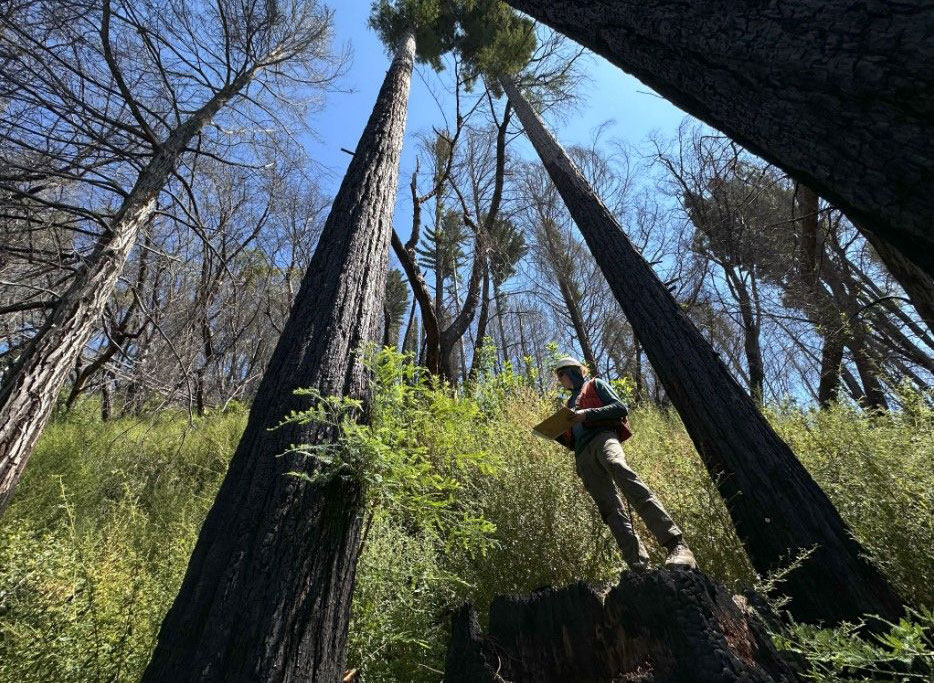
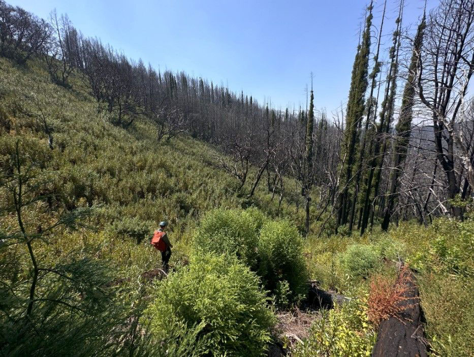
SIG established 25 representative plots of one tenth of an acre each across the property and collected detailed field data and from above using Uncrewed Aircraft Systems and satellite imagery.
Through interpretation of satellite imagery we found that 78 percent of the Cascade Creek Property had burned at high severity. Redwoods have the capacity to resprout from the base and the crown, meaning that even badly fire-damaged trees may recover. SIG monitoring confirmed that even in high-severity burn areas, almost 4 out of 5 redwood trees were resprouting after a year. Larger trees had the best prospects, with 90 percent expected to survive.
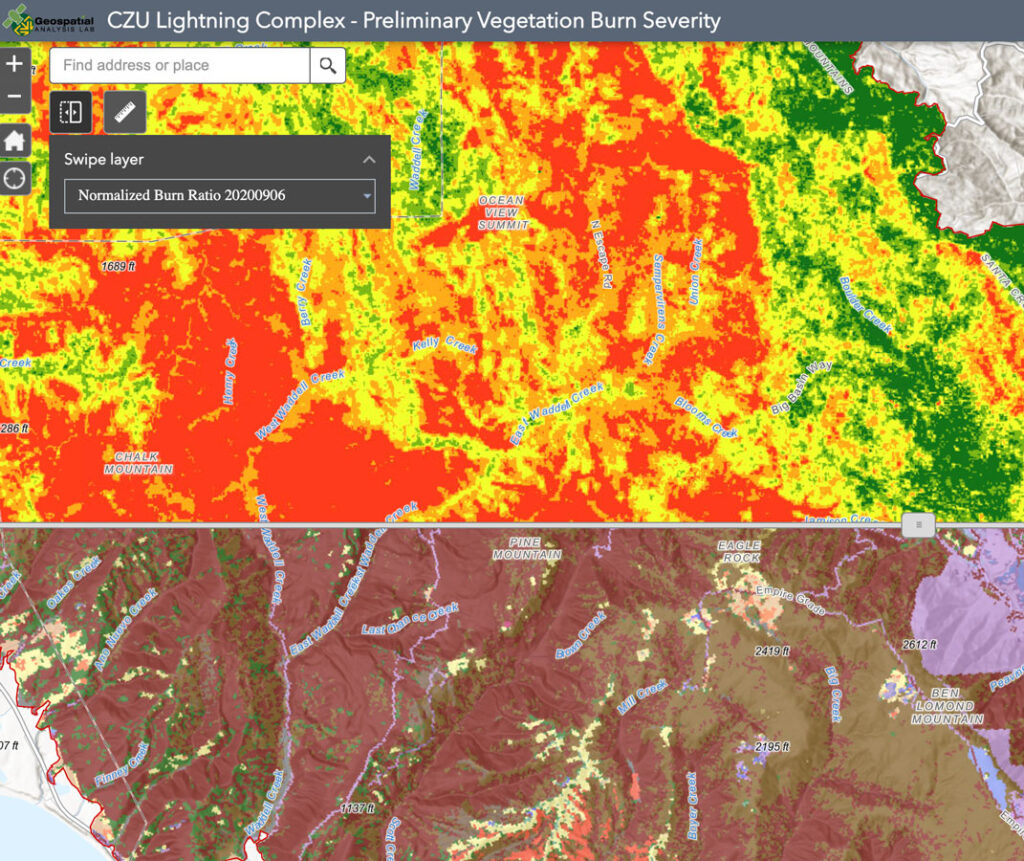
SIG was able to complete a fire severity map of the CZU Lightning Complex Fire within weeks of the burn, allowing the landowner and the public to understand the changes to the area, and to begin to plan for recovery informed by solid open science.
And ongoing monitoring has enabled Save the Redwoods to understand the process of recovery on their land – including the recovery of the endangered marbled murrelet, a coastal marine bird that nests in old growth redwoods. The high survival rate of large trees indicates that nesting habitat will persist, though it may take years as burned trees put out new sprouts.