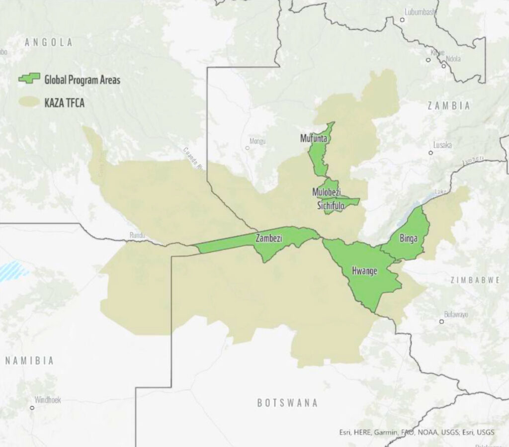
Environmental Mapping

Case Study

Developing Land Cover Mapping Technology for the KAZA Region

Classifying and mapping attributes of the Kavango-Zambezi Transfrontier Conservation Area faster than ever

Kaza Mapping

Spatial Informatics Group developed a toolset for the Kavango-Zambezi Transfrontier Conservation Area (KAZA) that uses a Regional Land Cover Monitoring System (RLCMS) to map land cover classifications in the area. KAZA, the second largest terrestrial conservation area in the world, comprises parts of five countries in Southern Africa. SIG’s system, built with Google Earth Engine, is intended to provide local users with easy-to-use technology to improve monitoring of the area.

A Multilateral Project for Sustainable Agriculture

WWF Germany and the German Federal Ministry for Economic Cooperation and Development created the Global Program for Food Security and Protection for the KAZA region, a protective measure that aims to promote ecological consideration in local agriculture. Measuring the impact of such a project requires earth observation through remote sensing.
Kaza Mapping
Sophisticated Analysis

Sophisticated Analysis

The toolset, called KAZA Land Cover Monitoring System (KAZA LCMS), is more nuanced than other available options because of its RLCMS framework. It allows users to rapidly prototype land cover maps through its easy-to-use interface. The KAZA LCMS puts the power of cloud computing in the hands of regional experts, enabling them to improve their mapping results over time as more data and insights become available.

Coordinated Cloud Tools

KAZA LCMS encompasses an end-to-end land cover mapping process. It supports users by generating training data and leveraging machine learning models, then performing accuracy assessments and area estimation of each land cover type. Users can do all this from a command-line interface on their local computer while the tool runs data processing in the cloud on Google Earth Engine.
Coordinated Cloud Tools