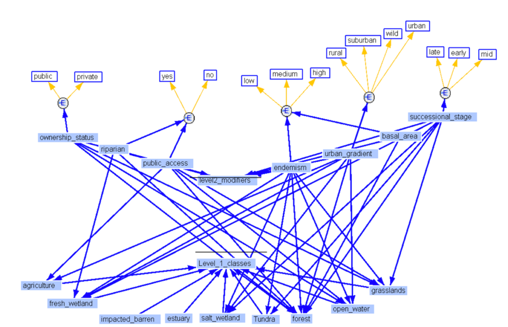
Ecosystem Services

Case Study

Mapping the Off-Site Benefits from Protected Areas’ Ecosystem Services

Two approaches to quantifying and assessing ecosystem services

New Approaches to Old Problems

In analyzing the provincial parks system in Ontario, Canada, SIG compared two different methodologies for quantifying and assessing the flow of ecosystem services in order to explore new frameworks for management.

Difficulties in Quantifying Ecosystem Services

Though these services are vital to humans, there are often difficulties in quantifying them; landscapes can be vast and difficult to measure, and service benefits can be difficult to understand when they are enjoyed far from their origin. These challenges present opportunities for using spatial data to better evaluate the benefits of these places, in terms of both quantity and potency.
Quantifying Ecosystem Services
Graph of Ontologies and ESV
Testing Approaches

Testing Approaches

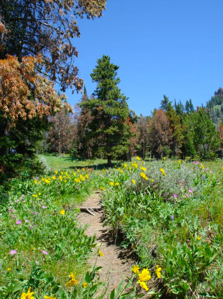
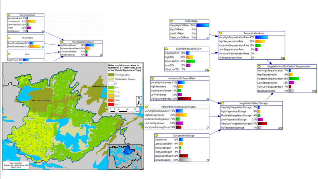
The system of protected areas in Ontario, Canada, is an excellent example of landscapes that provide beneficiaries with a wide range of essential services, including clean water, pollination, temperature regulation, carbon sequestration, and, critically, recreation.

Value Transfer vs ARIES

MNR teamed up with Spatial Informatics Group to execute this ambitious project. Two parks–Algonquin Provincial Park and Lake of the Woods–were chosen as study areas within which to test two approaches to understanding ecosystem services.

One was the traditional and widely used “value transfer” approach that imputes the value of ecosystem services from a landscape by comparing it with similar areas where economic valuation studies have been performed. The other approach was to use the AI-based ARIES (Artificial Intelligence for Ecosystem Services) system to quantify spatial connections between ecosystems and their beneficiaries. This more rigorous approach determines both value and spatial relationships.

Value Transfer vs ARIES
Photo source: Austin Troy
Ontario value transfer analysis
Ontario Modeling Project

Ready for Modernization

While the value transfer analysis estimated economic values for the flow more than a dozen ecosystem services across 18 land cover types, the ARIES approach involved far more detailed modeling of four ecosystem services: carbon sequestration, recreation, surface water supply, and sediment regulation. These models quantified the spatial connection between ecosystems and their beneficiaries. Together, SIG’s work served as an important first step in bringing a new suite of modern, powerful tools for managing resources in Ontario.