Driving Impact with Earth Observation Foundation Models

Followers of environmental issues in the Amazon scarcely go a week without seeing news about threats to the biome. The region has been devastated with countless and constant hazards. For example, each year it experiences natural hazards like wetland degradation, salinization, destructive flooding, and severe fires, all compounded by climate change.
SIG And SIG-NALS Latest Newsletter Is Online

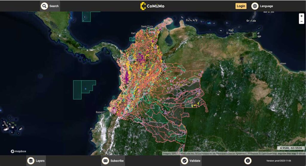
SIG co-developed software to remotely monitor gold mining activity in Colombia. Illegal mining is a driver of deforestation and this project aims to empower authorities to respond quickly and appropriately. CoMiMo, which is available for desktop in both English and Spanish, uses satellite imagery and artificial intelligence to identify threatened areas.
Pinchot Institute Works With SIG

SIG co-developed software to remotely monitor gold mining activity in Colombia. Illegal mining is a driver of deforestation and this project aims to empower authorities to respond quickly and appropriately. CoMiMo, which is available for desktop in both English and Spanish, uses satellite imagery and artificial intelligence to identify threatened areas.
SIG Presents LiDAR Based Projects In Tahoe

SIG co-developed software to remotely monitor gold mining activity in Colombia. Illegal mining is a driver of deforestation and this project aims to empower authorities to respond quickly and appropriately. CoMiMo, which is available for desktop in both English and Spanish, uses satellite imagery and artificial intelligence to identify threatened areas.
Carbon Dioxide Emissions Calculations For Forest Biomass Energy Projects Are Dependent Upon Regionally-Specific Conditions

An issue brief recently released by the Natural Resource Defense Council (NRDC) highlighted the importance of regional studies of biomass energy development. The brief relied on a model developed by the Spatial Informatics Group (SIG) to assess the lifecycle greenhouse gas emissions of energy derived from forest biomass in a nine-state region of the southeast United States. The model built on prior work conducted on behalf of the Southern Environmental Law Center and the National Wildlife Federation in 2012.
Spatial Informatics Group (SIG) And The University Of Vermont (UVM) Team Up To Demonstrate Small Unmanned Aircraft System (SUAS) Remote Sensing Capabilities In The Lake Tahoe Region

SIG co-developed software to remotely monitor gold mining activity in Colombia. Illegal mining is a driver of deforestation and this project aims to empower authorities to respond quickly and appropriately. CoMiMo, which is available for desktop in both English and Spanish, uses satellite imagery and artificial intelligence to identify threatened areas.
New Report Reveals Wildfire Is Not Just A Public Lands Issue

SIG co-developed software to remotely monitor gold mining activity in Colombia. Illegal mining is a driver of deforestation and this project aims to empower authorities to respond quickly and appropriately. CoMiMo, which is available for desktop in both English and Spanish, uses satellite imagery and artificial intelligence to identify threatened areas.
SIG Participates In The 6th International Wildland Fire Conference, Pyeongchang, Korea

SIG co-developed software to remotely monitor gold mining activity in Colombia. Illegal mining is a driver of deforestation and this project aims to empower authorities to respond quickly and appropriately. CoMiMo, which is available for desktop in both English and Spanish, uses satellite imagery and artificial intelligence to identify threatened areas.

