Environmental Mapping

Case Study

Neural Network Crop Mapping in Cambodia

Monitoring Agricultural Progress with Machine Learning

Using TensorFlow for Geospatial Analysis

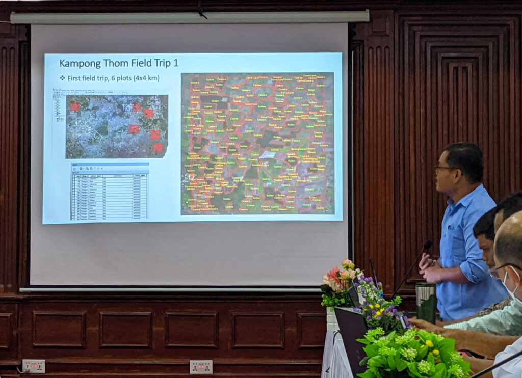
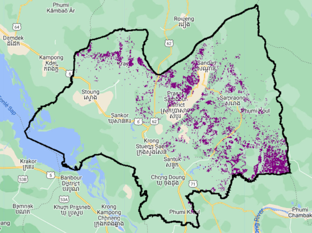
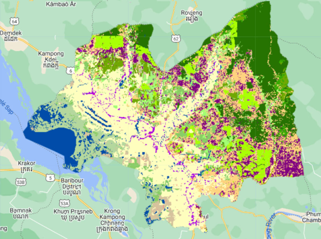
Under the Paris Agreement’s Enhanced Transparency Framework (ETF), Cambodia, like all other nations, is required to create high-resolution land use maps to monitor their agricultural practices.

Working with SilvaCarbon and the Food and Agriculture Organization, Spatial Informatics Group developed a machine learning model with TensorFlow, Google’s suite of open source AI technology. The software is used to manage progress in the agricultural sector, and to improve policy and planning.

Lack of Monitoring Precluded Much Needed Funding

The requirement to accurately monitor land cover and agriculture through the use of high-resolution imagery leaves countries like Cambodia in need of new geospatial solutions in order to stay in compliance. SIG’s commitment to open source tools helps ensure technology like this remains accessible, in terms of access, cost, and ease of learning.
Lack of Monitoring Precluded Much Needed Funding
Priorities of Research​

Priorities of Research

Other than developing the necessary tools to comply with the ETF, officials prioritized mapping certain crop types to improve both efficiency and profit. Cambodian agriculture depends largely on crops like cashews, mangos, rice, maize, and others. Another important benefit of the monitoring process is insight into greenhouse gas emissions, furthering the project’s impact on the local environment.

Software Development and Instruction

Through the use of TensorFlow, SIG developed an AI model that takes training data and infers a crop map as the output. The resulting map depends on the input data, which can be selected based on the target crop for each particular map. Once the model was developed, training was organized to teach Cambodian officials to use the tools via Google Earth Engine, allowing them to conduct their own analyses. More detailed information was provided on the use of neural networks too, including a freely accessible website with written instructions.
Cambodia Software Development and Instruction
Increased Efficiency​ for Cambodia
Cashew
Increased Efficiency​ for Cambodia
Land Cover

Increased Efficiency

Equipped with their new technology, Cambodian officials have been able to map over 4,000 kilometers of cashew plantations across 25 provinces, a process that had taken a year for just a single province before SIG’s solution was implemented.

Crop Mapping Today

Since working with SIG, Cambodia has managed to maintain their compliance with the ETF and continues to monitor their land use accordingly. Continued research will supply officials with key data to enhance their agricultural success, as well as essential information about greenhouse gas emissions. This data, along with continued support from SIG and partners, will help support Cambodia’s sustainable development.
Cambodia Crop Mapping Today

Training Website

This resource provides a collection of links to tools that can be used to map crops in Cambodia. Through this online training program, users can learn how to use Neural network machine learning algorithms to create accurate crop maps.