Fire Factor

The First High Resolution Wildfire Risk Model Covering the Conterminous United States

Solution Application

SIG Raises the Bar on What is Possible with Fire Risk Assessment

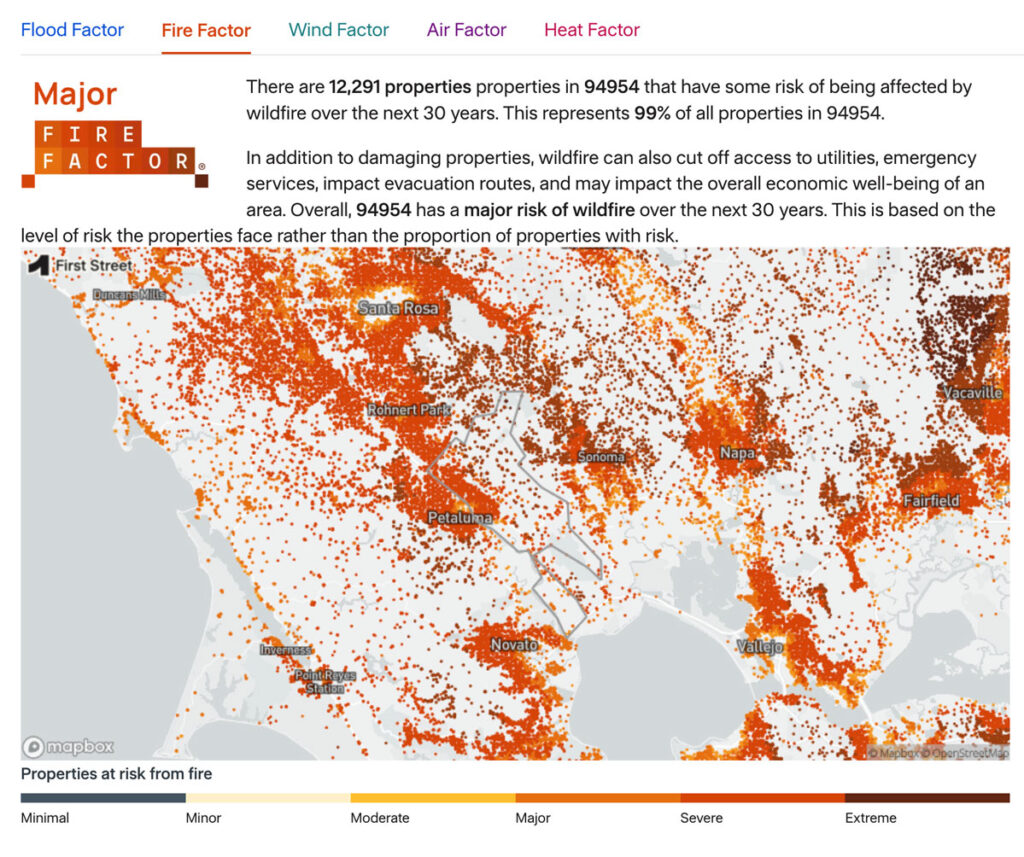
As part of the Pyregence Consortium, Spatial Informatics Group partnered with Cloudfire.ai and the risk analysis firm First Street Foundation to create a property-level wildfire risk model for every property in the conterminous United States. The First Street Foundation Wildfire Model (FSF-WFM) is the first national, climate-adjusted, property-specific wildfire risk assessment in America. FSF-WFM informs Fire Factor, First Street Foundation’s fire risk data product.

Technical Data

System Capabilities

System Support

Open Science

In keeping with the open science philosophy shared by First Street and SIG, FS-WFM models and methods are completely transparent. Data is available separately. Together we developed a peer-reviewed scientific article whose authors include a number of SIG scientists.

Fire Factor Video
Existing Options Were Inadequate

First Street Foundation, which collates and provides risk data to governments, insurers, and the public, needed to quantify wildfire risk at the parcel level across the US, but existing options did not have the resolution required to assess individual addresses. First Street Foundation turned to the Pyregence Consortium; our long experience with science-backed wildfire modeling made us the natural partner.
Fire Factor fire risk assessment
Fire Factor Website

Over 100 Million Simulated Wildfires

SIG’s scientists began by gathering open science data from federal,state, and local agencies throughout the US. They adapted the US Forest Service and US Department of the Interior’s LANDFIRE database, which contains information about vegetation, fuels, and fire regimes. By adding impacts on these factors from previous harvests, fuel reduction treatments, and wildfires – estimates that were verified and adjusted using imagery from NASA satellites – SIG’s team created a comprehensive, accurate, and up-to-date picture of the state of wildfire fuels in the lower 48.

From this starting point, every year SIG’s team calculates wildfire risk for each location for the current year and for a 30-year projection, modeling burn probability, maximum and mean flame length, and potential ember spread. Ultimately, they model more than 100 million possible wildfires at 30m resolution.
This workflow, developed in Google Earth Engine, imports all available wildfire and forest treatment data to create near-real time fuels layers.

In later iterations of FS-WSM, SIG’s team added significant upgrades, including dynamically adjusting fire spread rates based on terrain and built features, accounting for active suppression, and more accurate calibrations of fire size distributions.
First street

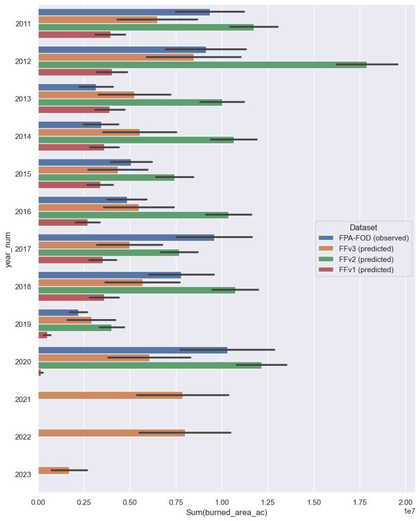
Burn area prediction by Fire Factor version, compared to Fire Occurrence Database (FOD).

Black bars represent the internal variability range (2 standard deviations on either side of the central estimate).

Pinpoint Wildfire Risk Assessment

Incorporating FS-WFM into their Fire Factor product has allowed First Street Foundation to integrate wildfire risk with additional factors such as the vulnerability of specific buildings. Fire Factor’s hyperlocal resolution fosters an extremely granular understanding of fire risk, actionable at the level of individual addresses. The annualized product is being updated continually, making First Street the undisputed leader in fire risk data services in the United States.