Historical Drought Susceptibility
In the Lower Mekong region, droughts are a common occurrence that can seriously impact food and water security while also threatening biodiversity in affected areas. While ENSO (El Niño) is the main driver of droughts in the Lower Mekong, climate change may negatively affect the frequency and intensity of droughts. Access to high quality forecasting information is critical to the region’s future, both economically and in terms of human well being.
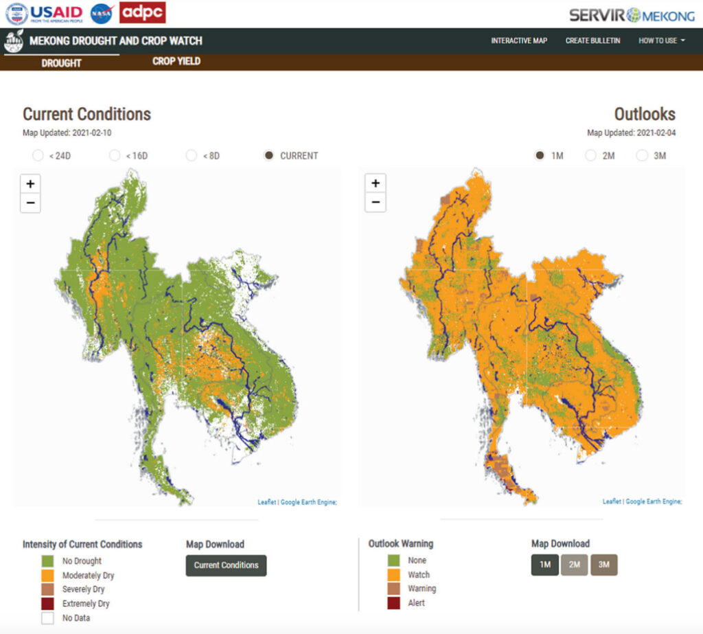
Creating Solutions for the Mekong
To solve these issues, SIG and partners created the Mekong Drought & Crop Watch software, which uses Python and Google Earth Engine to generate temporal maps of the Lower Mekong. Geospatial data permits these maps to display projected rainfall for ongoing or potential future drought events, and also provide weather-informed insights for agricultural decision making. Policymakers gain access to a wealth of data to keep locals safe during droughts, and can also prepare for the future with more specificity than ever before. Reducing economic strain on the agricultural sector is another key benefit of the system.