HYDRAFloods

Freely-Accessible Flood Data for Emergencies

Solution Application

HYDRAfloods

Open Source

Detect Floods with Remote Sensing

As part of SERVIR-SEA and with the Asian Disaster Preparedness Center (ADPC), SIG developed HYDRAFloods, public access flood monitoring software that detects flood events in near real-time through the use of satellite data. Artificial intelligence tools within Google Earth Engine make the program even better at detecting surface water levels, speeding up the process to keep people safe.

Technical Data

System Capabilities

System Support

Rainfall, Flooding, and Climate Change

Flooding is a common event during rainy seasons In Southeast Asia, threatening communities and their livelihoods throughout the region. It is critical for emergency responders to have access to as much information as possible when disaster strikes. Prior to HYDRAFloods, data on the impacted areas and the extent of present danger was not readily available to first responders, hindering their response times and effectiveness.

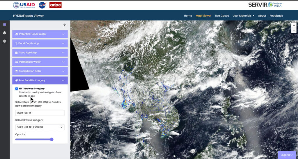
Floods viewing with HYDRAFloods

Monitor, Respond, and Discover

Built with Google Earth Engine, the software uses satellite imagery of impacted areas, cloud computing programs that accelerate processing, and machine learning and AI to improve the accuracy of the system’s predictions. Additionally, HYDRAFloods’s dashboard gives users access to datasets outlining previous flood and rainfall events, making the program a useful hydrological research tool as well.

Ongoing Disaster Preparedness

HYDRAFloods has been used across Southeast Asia to prepare for and respond to flooding events in Cambodia, Vietnam, and beyond. Past events are cataloged on the website and can be viewed at any time, giving users access to a repository of information to boost their preparedness.
HYDRAFloods Application

HYDRAFloods Application