Natural Hazards

Case Study

Community Wildfire Risk Mitigation Assessment

Pilot Research Project on Methods for Quantifying Wildfire Hazard and Risk

Understanding the Landscape Effects of Wildfire Resiliency Treatments in the Wildland-Urban Interface

Forests in California are increasingly vulnerable to damaging, high severity wildfires. Not only have climate change, fire exclusion, and past forest management practices created very favorable conditions for mega fires, but increasing human settlement of the wildland-urban interface and intermix (WUI) has dramatically increased the potential lives and values at risk.

How Do Local Interventions Affect the Landscape?

Measures to reduce risk, such as defensible space regulations and home hardening, as well as fuel reduction treatment, are in place throughout the state, but the integration of their landscape-level effects on potential structure losses have not been well studied.
Local Interventions
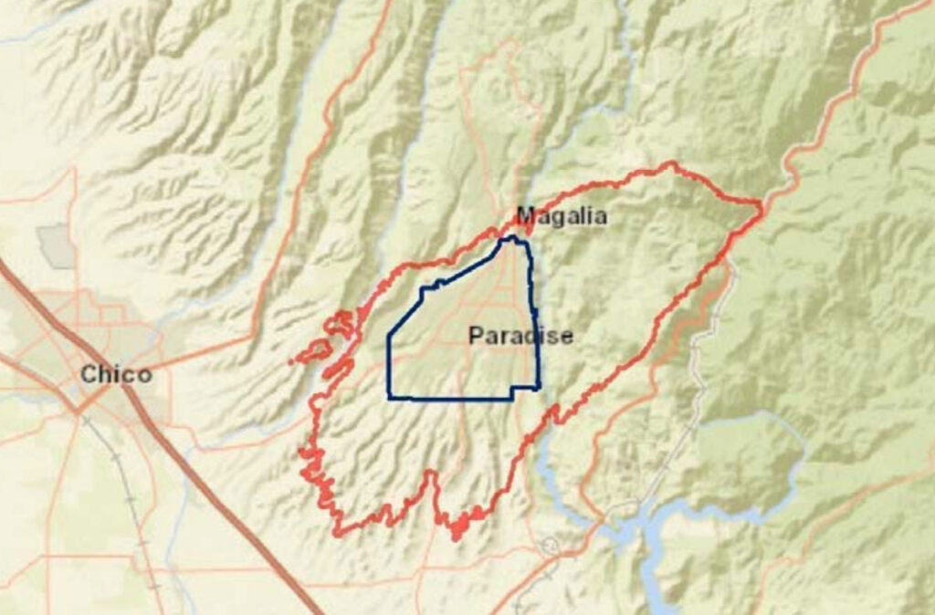
Camp fire map
Paradise, CA study area boundaries shown in context to the Camp Fire burn perimeter in the map

Getting the Lay of the Land

CAL FIRE asked Spatial Informatics Group to undertake a pilot study to explore data, methods, and models and develop information and guidance to aid in planning fuel treatments and in implementing defensible space in the WUI of the communities of Nevada City, Grass Valley, and Auburn, California. SIG was also tasked with evaluating inspection and defensible space compliance data related to properties involved in the 2018 Camp Fire to evaluate the effects of building features, building codes, and defensible space in a big wildfire.

Comparing Two Methodologies

The project compared two methods for calculating carbon emissions associated with fuel treatments: the Reduced Emissions from Megafires Protocol that SIG developed and another developed by California’s Greenhouse Gas Reduction Fund. SIG’s protocol was found to be more robust and better able to capture the benefits of fuel treatments.

Results

Regardless of analytical method, results showed that the expected loss of value due to a simulated wildfire decreased as the proportion of the landscape subjected to fuels treatment increased and as the proportion of parcels in compliance with defensible space regulations increased.

They also showed that structure loss or survival is attributed to structure hardness, with newer structures compliant with more recent California building codes less susceptible to damage or destruction.

However, parcel-level landscape characteristics were less predictive, with defensible space clearance showing only minimal significance.
Community Wildfire Risk
CALFIRE, Ready for Next Steps

Ready for Next Steps

This project demonstrated that it is possible to simulate wildfire behavior and risk effects of changes in parcel-level defensible space compliance in combination with fuel reduction treatments. It is an important first step towards developing an online statewide fuels treatment planning decision support system.