Login
Forget?

Forget your password?
Remember Password?
  • About
    • What we do
    • Our Team
    • Where We Work
    • Project Showcase
    • Institutions
    • Career Opportunities
    • GSA
    • Client Resources
    • Media Resources
  • Services
    • Ecosystem Services
    • Environmental Mapping
    • Unmanned Aircraft
    • Sustainable Cities
    • Forest and Agriculture Management
    • Carbon Offsets
    • Natural Hazards
    • Climate Change
    • Water Resources
  • Blog
  • Technology

Archives

Monthly Archive for: "May, 2022"
Home » Archives for May 2022
 Predicting the Future of Wildfires? It’s Complicated
  2
By Justine Bui
In Wildfires
Posted May 20, 2022

Predicting the Future of Wildfires? It’s Complicated

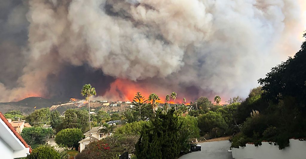
This week, many large media platforms ran front-page or lead stories on the launch of Fire Factor, a new wildfire prediction tool by First Street Foundation that lets property owners look up [...]

READ MORE
Navigation
  • About
    • What we do
    • Our Team
    • Where We Work
    • Project Showcase
    • Institutions
    • Career Opportunities
    • GSA
    • Client Resources
    • Media Resources
  • Services
    • Ecosystem Services
    • Environmental Mapping
    • Unmanned Aircraft
    • Sustainable Cities
    • Forest and Agriculture Management
    • Carbon Offsets
    • Natural Hazards
    • Climate Change
    • Water Resources
  • Blog
  • Technology
Contact

Spatial Informatics Group,
2529 Yolanda Ct.
Pleasanton, CA 94566

Recent Posts
  • Predicting the Future of Wildfires? It’s Complicated
    Predicting the Future of Wildfires? It’s Complicated
    May 20, 2022
  • SIG works with Google and other partners on new tools that democratize offline mapping
    SIG works with Google and other partners on new tools that democratize offline mapping
    January 13, 2022
  • Mapping Forest Degradation in Nepal with Remote Sensing
    Mapping Forest Degradation in Nepal with Remote Sensing
    July 19, 2021
Sign up for our newsletter
Copyright Spatial Informatics Group, All Rights Reserved © 2020

Start typing and press Enter to search