Login
Forget?

Forget your password?
Remember Password?
  • About
    • What we do
    • Our Team
    • Where We Work
    • Project Showcase
    • Institutions
    • Career Opportunities
    • GSA
    • Client Resources
    • Media Resources
  • Services
    • Ecosystem Services
    • Environmental Mapping
    • Unmanned Aircraft
    • Sustainable Cities
    • Forest and Agriculture Management
    • Carbon Offsets
    • Natural Hazards
    • Climate Change
    • Water Resources
  • Blog
  • Technology

Archives

Monthly Archive for: "April, 2016"
Home » Archives for April 2016
 SIG and The University of Vermont-Spatial Analysis Lab (UVM-SAL) Partner to Offer High-Resolution Imagery for Small Area Mapping
  0
By Jenna Jadin
In Uncategorized
Posted April 28, 2016

SIG and The University of Vermont-Spatial Analysis Lab (UVM-SAL) Partner to Offer High-Resolution Imagery for Small Area Mapping

A picture is worth a thousand words, but it helps to have the right picture for your application. That is why SIG is partnering with the University of Vermont-Spatial Analysis Lab to offer a full [...]

READ MORE
 SIG Working in Kenya on Biomass Supply Chain Management
  0
By Jenna Jadin
In Uncategorized
Posted April 21, 2016

SIG Working in Kenya on Biomass Supply Chain Management

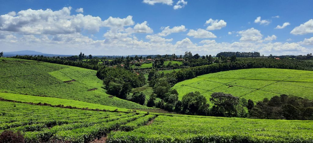
Dr. Thomas Buchholz, Senior Scientist at SIG, will be in Kenya this spring to provide assistance in biomass supply chain management to the Kenya Tea Development Agency (KTDA). He is collaborating [...]

READ MORE
 Our March-April Newsletter is Now On-line
  0
By Jenna Jadin
In Uncategorized
Posted April 13, 2016

Our March-April Newsletter is Now On-line

Our March-April Newsletter is now available on-line. Learn more about our recent work with the Indian Land Tenure Foundation along with information on recent publications and presentations by our [...]

READ MORE
Navigation
  • About
    • What we do
    • Our Team
    • Where We Work
    • Project Showcase
    • Institutions
    • Career Opportunities
    • GSA
    • Client Resources
    • Media Resources
  • Services
    • Ecosystem Services
    • Environmental Mapping
    • Unmanned Aircraft
    • Sustainable Cities
    • Forest and Agriculture Management
    • Carbon Offsets
    • Natural Hazards
    • Climate Change
    • Water Resources
  • Blog
  • Technology
Contact

Spatial Informatics Group,
2529 Yolanda Ct.
Pleasanton, CA 94566

Recent Posts
  • Predicting the Future of Wildfires? It’s Complicated
    Predicting the Future of Wildfires? It’s Complicated
    May 20, 2022
  • SIG works with Google and other partners on new tools that democratize offline mapping
    SIG works with Google and other partners on new tools that democratize offline mapping
    January 13, 2022
  • Mapping Forest Degradation in Nepal with Remote Sensing
    Mapping Forest Degradation in Nepal with Remote Sensing
    July 19, 2021
Sign up for our newsletter
Copyright Spatial Informatics Group, All Rights Reserved © 2020

Start typing and press Enter to search